
Daniel Simeone
The theme of the 2015 annual meeting of the Institut d’histoire amérique française (Institute for the History of French North America), the principal French-language conference for historians of Quebec and French-speaking North America, was Urbanités. French and English share the dual interlinked definitions of the word urbanity. It refers to both the condition of being urban and to behavioural qualities of politeness and refinement. Both cities and the ‘refined’ behaviour of their inhabitants are historically constructed. The nature of place and the physical realities of urban geometry can leave echoes across centuries. People may come and go. Buildings may come and go, but they leave traces that impact present experience of space. Different speakers approached ideas of place and time and their inter-relationships, but somewhat remarkably, some of these ideas cropped up again and again in different panels.
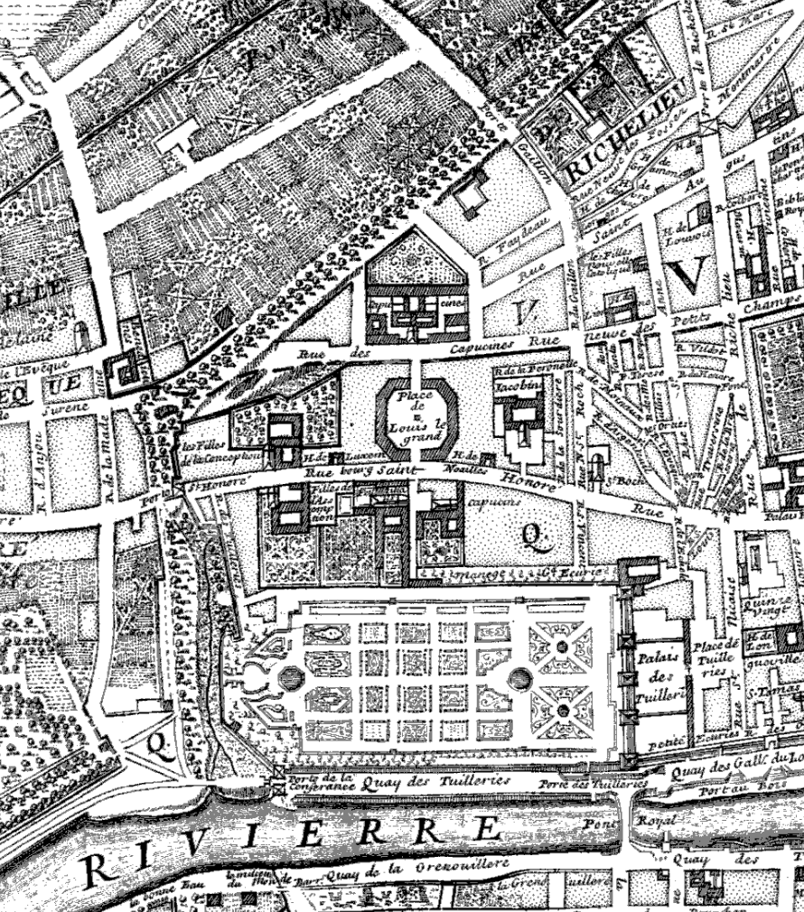
Detail: Huitième Plan de Paris divisé en ses Vingts Quartiers / Par N. de Fer, … ; pour servir au Traité de la Police pour M.L.C.D.L.M.; Nicolas de Fer, Cartographe du modèle; Nicolas de La Mare, Cartographe, 1705.
Bibliothèque nationale de France
Keynote speaker Joan DeJean, from the University of Pennsylvania, explored the development of Paris as a city. She dismisses the received notion that its urban shape and structure is fundamentally rooted in the re-figuring of the city by Georges-Eugène Haussmann in the 19th century, but was shaped earlier still. The 1670 destruction of the city walls of Paris on the order of Louis XIV opened up land for grand urban designs. The first ‘boulevard’ – an awkward French rendering of the Dutch ‘bolwerc’ meaning a fortification wall – was built on the land freed by the the demolished city walls. With road surfaces on either side of a central treed pedestrian area, citizens of Paris, from all (or perhaps most) social classes walked on the boulevard. DuJean argued that it became a place of social mixing unlike anywhere else in contemporary urban Europe due to the physical geography of the boulevard. She traced the boulevard as an urban form and its impact on urbanity – both the city and the behaviour.
Members of the Laboratoire d’histoire et de patrimoine de Montréal (the History and Heritage Labortory of Montreal, hosted at the Université du Québec à Montréal – UQÀM) Léon Robichaud (Université de Sherbrooke), Joanne Burgess (UQÀM), Alan Stewart (Dawson College), and Yvon Gagnon (UQÀM), engaged with the historical and the spatial in their panel on the visualization of historical phenomena in Montreal. Robichaud introduced the Laboratoire’s database and visualization tools developed by the LHPM, linking information on specific buildings, business-use information on the buildings, census and other data on tenants and owners, and land survey data. The remarkable database allowed Burgess and Stewart to analyze the change over time of the distribution of grocers, both retail and wholesale, in the mid-to-late 19th century. As the residential and commercial nature of the Vieux-Port (the ‘Old Port,’ the oldest part of Montréal) changed, so too did the spatial distribution of grocery suppliers. The physical placement of buildings in the Vieux-Port and the arrangement of the port facilities structured commercial interactions. On the industrial scale, Yvon Gagnon examined the principal industrial zones surrounding the entrance (on the Montreal end) to the Lachine canal(the Lachine canal bypassed rapids in the St. Lawrence river, and served as the cradle of the industrial revolution in Canada). He examined the impact of the early 19th century infrastructure project, built before railways, on much later industry. The spatial distribution of industry, even in a time of steam engines and railway, remain predicated upon the sites’ earlier access to shipping and to water power.
 The panel “Construire la ville” (Building the City) explicitly engaged with urban planning and the process of urbanization. Véronique Mondor (Laval) examined the morphological histories of Drummondville and Shawinigan, two cities located at a distance from the Québec-Montréal corridor, that each have urban forms structured by encounters with large industrial operations and specific physical geographies. Shawinigan was a company-town centred on hydro-electricity and related electricity-intensive industries, while Drummondville was shaped by the textile industry. Nari Shelekpayev (Université de Montréal) argued for a creation of the notion of “capitalité” – the nature of being a capital – in the rapid transition of Ottawa from lumber-industry backwater to federal capital. Martin Drouin (UQÀM) examined the designation of Vieux-Montréal as an historic district in the 1960s. He chronicled a complete change in the understanding of the meaning of heritage. An early-1960s municipal report observed that there were but twenty-some buildings in the entirety of Vieux-Montréal of any historical value. By the time of the designation of the district as an historic district, the entire urban shape, the road forms, and the buildings developed on the sites of earlier buildings and their relationships to and with the port, formed part of the understanding of the meaning of heritage. The echoes of decisions and accidents of urban design from the 16th through to the 20th centuries form part of the character of the historic district. Drouin noted that the Northern border of the district extended to Notre-Dame Street, but not quite all the way to the old city walls. The difference between the boulevards of Paris and the ruelle des Fortifications, an alley that literally runs underneath the headquarters of the newspaper La Presse could not be striking.
 But how and why did Montreal became an industrial city? This is the big question underlying Robert Sweeney’s monumental recent volume, Why did we choose to industrialize? Montréal, 1819-1849. Sweeney’s question demands that we consider the choices, mercantile and capitalist, industrial and commercial, that shaped the early 19th century city. The Lachine canal need not have been built. He rejects an historical determinism of a capitalist industrial revolution, and examines the choices made that structured Montreal as an industrial city. Chaired by Magda Fahrni (UQÀM), panelists Marc St-Hilaire (Laval), Lucia Ferretti (UQTR), and Martin Petitclerc (UQÀM) shared their reflections and reactions to Sweeney’s work. Ferretti critiqued Sweeney’s materialist perspective in what she saw as the work’s blindness on the category of nation. She posited a destruction of patrimonie (roughly, ‘heritage’) in its architectural form along national lines, and implicitly answered Sweeney’s titular question by rejecting the notion of a we choosing to industrialize. The we is instead a they, in the power-relationship between habitants (the French speaking, usually agricultural, proto-working class of the 18th and early 19th centuries) and the growing number of British inhabitants of the city and colony.
The forms of modern cities are as complex as they are varied. L’urbanité is as much a question of geography as it is of choices. How and why do we choose to occupy the spaces that make up our cities? People inhabit cities and make them their own. Their choices are made in historical contexts and those choices echo through time and space. Physical geographies, urban geographies, and cultural geographies collide in the creation of urbanité.
Daniel Simeone is a late-stage doctoral candidate at McGill University in Montreal. His project considers the history of bankruptcy in Québec, with particular emphasis on the commerical capital of British North America, Montreal, in the mid-to-late 19th century. You may find him nattering on about bankruptcy and other topics on Twitter at @Daniel_Simeone.
[Editor’s Note: For another perspective on this year’s IHAF Conference, read last week’s post by Maxime Dagenais.]
Featured Image: Plan de Montréal, 1687 à 1723 (Detail), in Le Vieux Montréal, 1611-1803, eds. H. Beaugrand and P.-L. Morin (Montreal: H. Beaugrand, 1844). Bibliothèque et Archives nationales du Québec.
